

Water for Brandenburg
Researchers at the Leibniz Centre for Agricultural Landscape Research (ZALF) have investigated how water from streams can be specifically stored in the soil during wet periods. The study was published in the Journal of Hydrology: Regional Studies. Using an area in the lower Spree catchment in Brandenburg as an example, the team demonstrated using a computer model that naturally occurring small depressions in the landscape could absorb excess stream water, allowing it to seep slowly into the soil and subsequently stabilise groundwater levels and stream flows. In the calculations, this caused the groundwater level to rise locally by up to 2 metres. Water flow in connected streams was increased by up to 15 per cent.
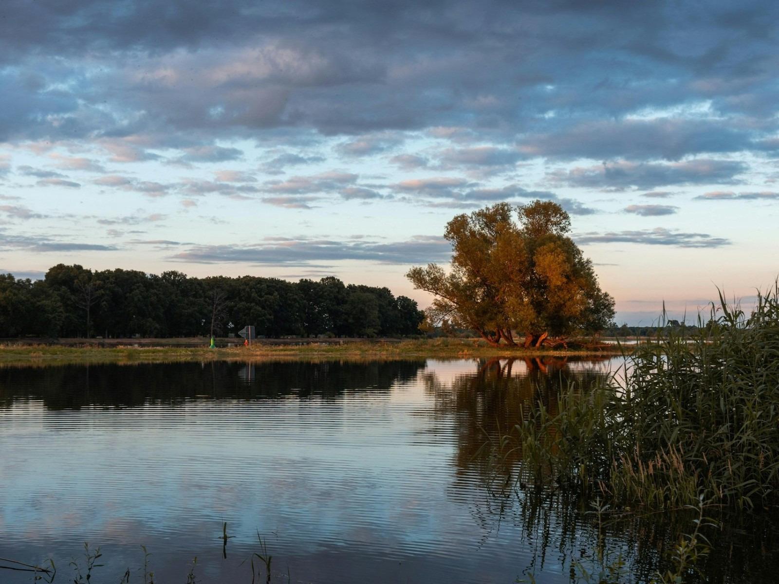
Retaining water in the landscape in a targeted manner
Brandenburg is one of Germany’s driest regions. Prolonged periods of drought and heavy rainfall make it more difficult to ensure a steady supply of water throughout the year. In the past, many landscapes in north-eastern Germany were altered by ditches and drainage systems in such a way that water runs off quickly. Whilst this often helps with the use of farmland, it can become a problem in dry years.
The researchers therefore investigated a method known in German as ‘controlled groundwater recharge’. This involves water that is temporarily available in excess in a watercourse during wet periods not being channelled away immediately, but instead being directed into suitable shallow depressions. There, it seeps away slowly – much like rainwater in garden soil, only in a deliberately planned and controlled manner.
“Our findings show that small natural depressions in the landscape can help retain water in the region for longer. This is particularly important as dry years become more frequent,” says Jan Stautzebach, lead author of the study and a researcher at ZALF.
A computer model and 30 years of data
For the study, the team used a model that simulates both surface water and groundwater together. This is important because streams and groundwater function as two interconnected parts of a system: if the groundwater level falls, a stream may receive less water. If it rises, the stream’s flow can be sustained during dry periods.
The researchers examined an area of around 4.5 square kilometres within the catchment area of the Demnitzer Mühlenfließ. The area comprises woodland, arable land and grassland. For their calculations, the team used weather and landscape data covering the period from 1991 to 2020. Various scenarios were examined to determine how much water from the stream could be channelled into nearby depressions suitable for infiltration, and how the soil, groundwater and stream would respond.
What is new about the study is that it did not merely calculate whether water infiltrates the soil. The team also investigated how this water subsequently affects connected streams. Their findings showed that the additional water moves slowly through the subsoil and can have an effect even over distances of several hundred metres. In the calculations, the influence on the groundwater level extended over more than 900 metres.
Hopes and concerns
The results show that the method can be particularly useful when implemented on a decentralised basis: in other words, not with large dams or powerful pumps, but with many smaller sites where water can seep away. The researchers note that large-scale installations with high energy requirements would be rather unsuitable for this region, as there is likely to be insufficient surplus water during prolonged dry spells.
At the same time, the study makes it clear that the method must be carefully planned. If too much water is introduced, lower-lying areas may become flooded. Whilst this may be desirable in moors or wetlands, it can cause problems near buildings or sensitive land-use areas. Plants may also be damaged if their roots remain in wet soil for too long.
The results are based on model calculations. They therefore show what would be possible under the chosen assumptions. For practical application, specific sites would need to be assessed on the ground: How well does the water infiltrate? Which areas might be affected? What pipes or ditches would be required? Who would operate and pay for the systems? The article does not yet specify any concrete costs.
With this new knowledge, authorities, water boards and land users could in future better assess where water can be retained within the landscape. A next step would be to investigate such sites in more detail and plan small-scale field trials. This would also involve assessing how much water can be abstracted from a stream without adversely affecting animals, plants and other land uses.
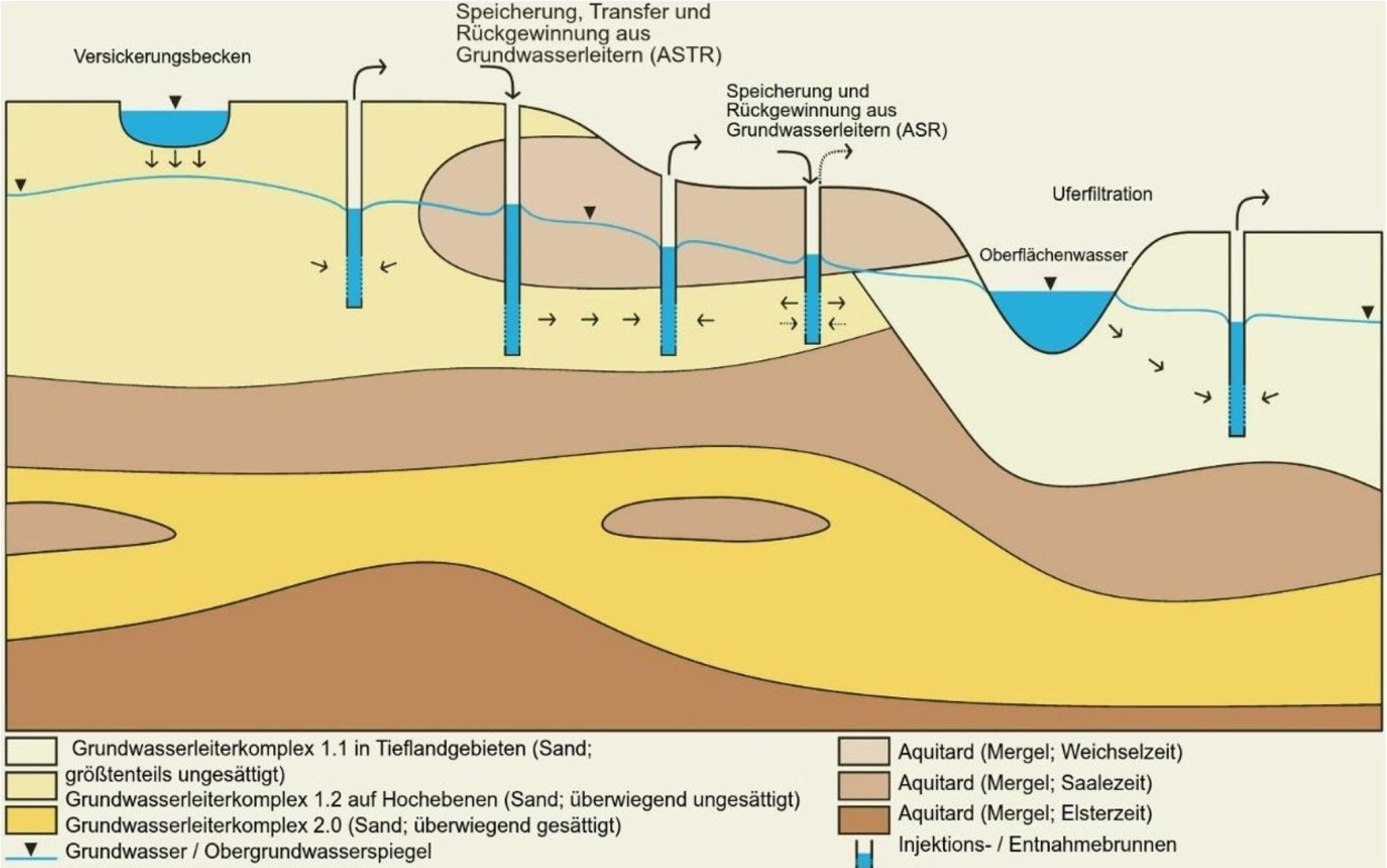
Schematic representation of the MAR types found in the hydrogeological setting of the study area. © Jan Stautzebach
Further information can be found via the DOI link to the original publication: https://doi.org/10.1016/j.ejrh.2026.103533
This work was carried out as part of the SpreeWasser:N project and funded by the Federal Ministry of Education and Research (BMBF) under grant number 02WEE1633B. The Leibniz Centre for Agricultural Landscape Research (ZALF), Müncheberg, is a project partner.
About the Leibniz Centre for Agricultural Landscape Research (ZALF) e. V. in Müncheberg, an institution of the Leibniz Association:

To help tackle global societal challenges such as climate change, food security, biodiversity conservation and resource scarcity, we develop and design farming systems within a landscape context that combine the need for crop production with sustainability. To this end, we combine complex landscape data with a unique set of experimental methods, new technologies, computer-based models and socio-economic approaches. ZALF research is systems research: ranging from processes in soils, plants and water, through relationships at field and landscape levels, to global impacts and the consideration of complex interactions between landscape, society and the economy. www.zalf.de